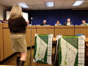
 The Hawthorne Environmental Commission and Green Team presented all Hawthorne Schools with Green Maps at the Board of Education meeting on January 15, 2013 to educate students on Hawthorne’s environment.
The Green Map, presented by Commissioner Rayna Laiosa and intern Erick Pinos at the meeting, is a computer-generated image of the Borough of Hawthorne that maps out all parks, recreation areas, public buildings, historical sights, schools, houses of worship and transportation.
“The goal was to get a map of Hawthorne to acknowledge trails and get people out in the community,” said Laiosa.
The Environmental Commission worked together to create this map by walking all of the nature trails/paths and gathering accurate historical information about buildings and important sites.
Intern Pinos (18) used his knowledge of graphic design to create this map and also the app for iPods, iPhones, and Android devices. “I feel this helps kids discover all of the uniqueness that Hawthorne has to offer,” said Pinos. While using this app, the user can click on any of the sites listed and find out information such as the history and other information. This app finds the user’s location and lists interesting things in that area.
All Hawthorne Schools have now received a framed copy of this map that will be hung up for all to see and enjoy. Hawthorne High School students can find their Green Map in the Library Media Center.
The online version of the map can be found at greenmap.org/Hawthorne and the app is called Green Map. Viewers can then type in “Hawthorne” to view the map which lets you know places of interest near you.
